April 18th, 2025
A short stop in Arizona and a few days in Silver City NM and we we’re on our way to California.
Tombstone (66m) or bust, O, wait, we only have an hour drive today so I think we’ll make it.
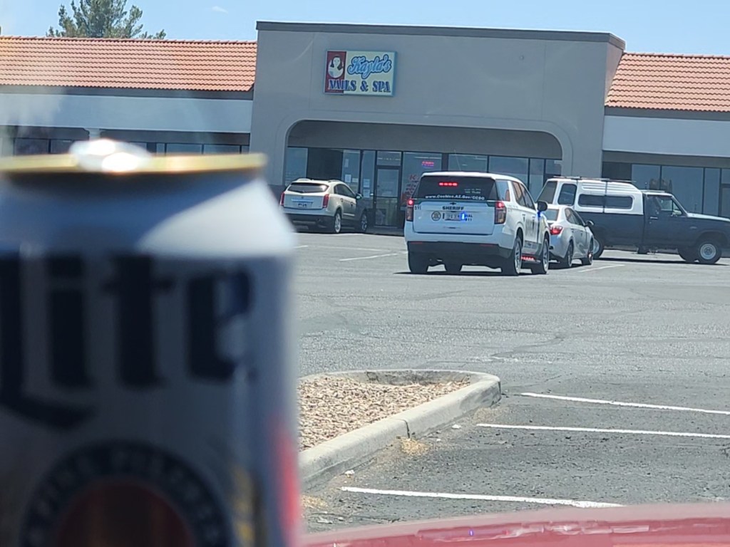
On our way we stopped at Benson AZ to do some shopping at Walmart, Safeway and Ace Hardware. On the way we found out what happened to Pink Floyd.
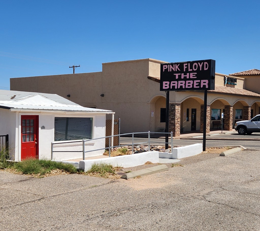
The Sheriff is giving someone a ticket in the Ace Hardware parking lot.
We are at The Lakes of St David RV Resort sixteen miles north of Tombstone.
This is not only an RV resort, they have Casitas and possibly an old hotel.
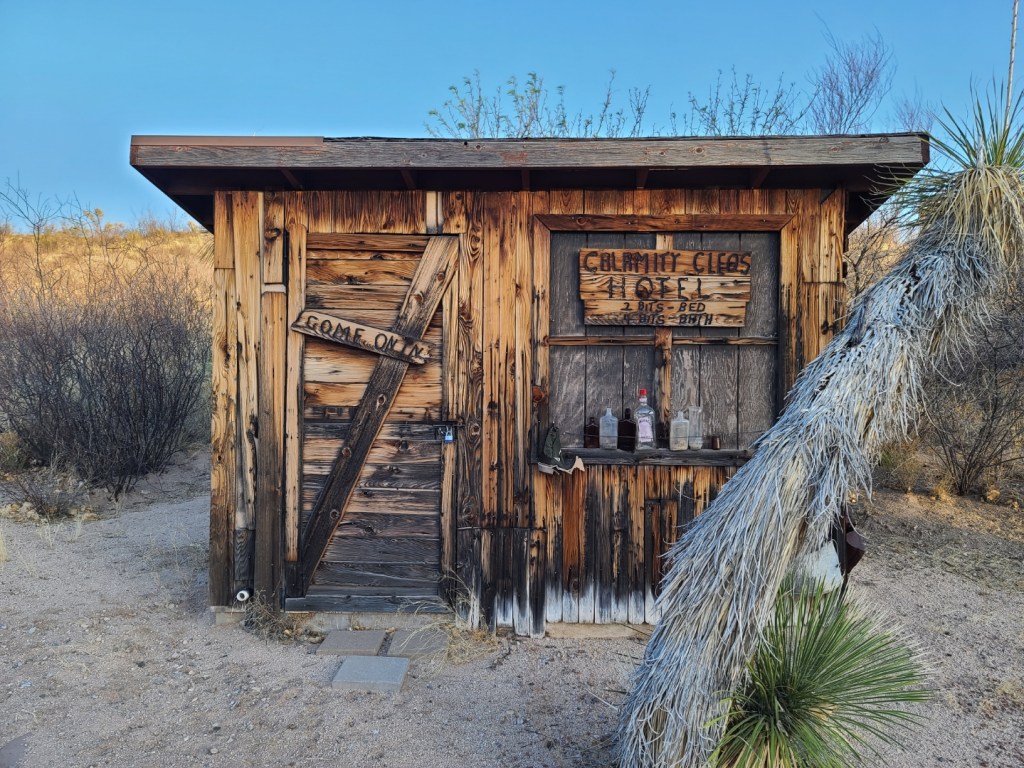

2 bits bed and 4 bits bath
Five star rating ☆☆☆☆☆
April 19th, 2025
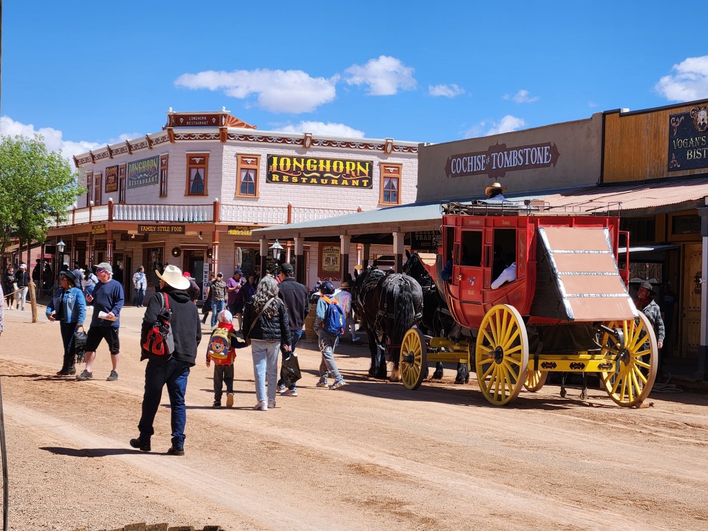
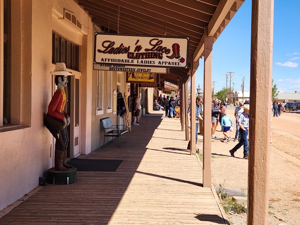
The Town Too Tough to Die
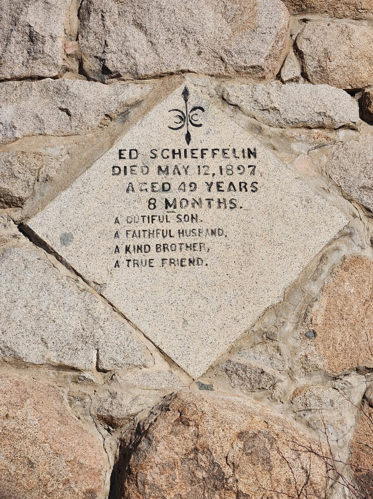
Tombstone AZ founded in 1879, got its name from Ed Schieffelin. Ed was part of a scouting voyage for the army looking for the Chiricahua (chir-i-cow-uh) Apaches. During his stay at Camp Huachuca (wa-chu-ka) he would waunder off and look for rocks. He was warned that the only thing he would find was his Tombstone. Ed got lucky and found silver. Because of the warnings he received from a soldier he named the mine Tombstone. When word got out about the silver strike, people headed to the area in hopes of getting rich and a town was formed near the mines and named after Ed’s first mine.
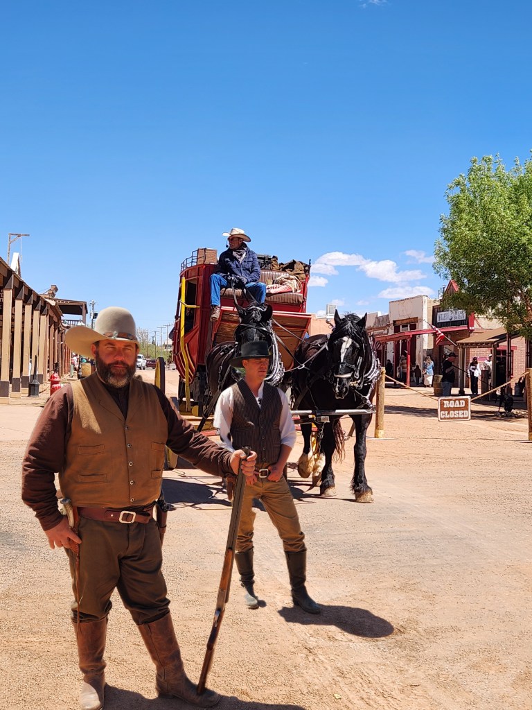
Hearing about all the gun fights, the infamously shoot out at the OK Corral and Boothill graveyard, I thought that Tombstone earned its name after the town was formed and maybe more deserving than the actual naming.
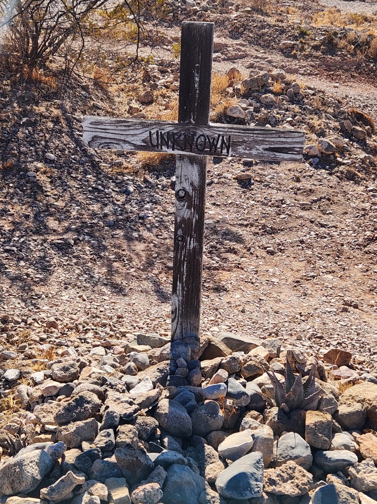
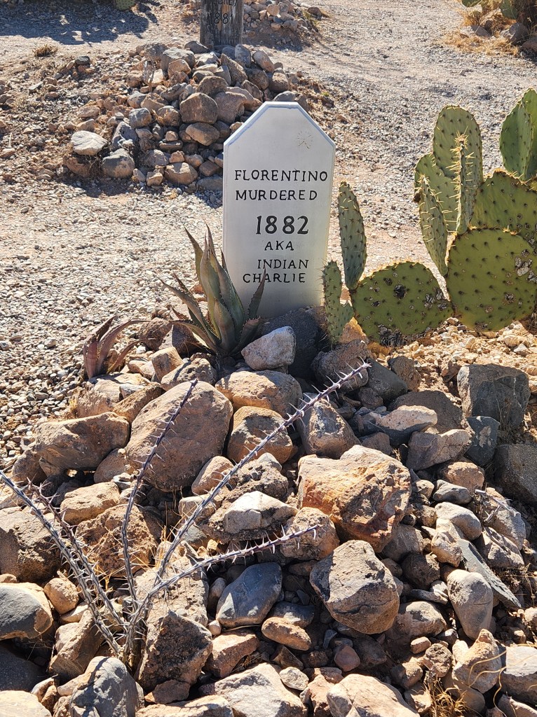
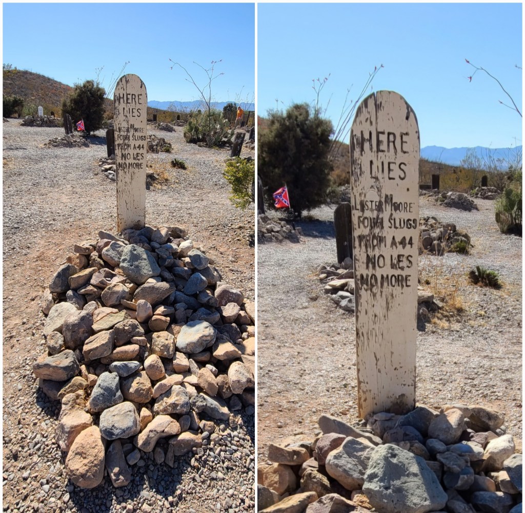
We have a town deserving of its name and a cemetery deserving of the name Boothill Graveyard. The cemetery was originally called “The City Cemetery” and renamed for tourism in the 1920s. Never the less with the towns history of violent deaths it is deserving of the name Boothill Graveyard.
Definitely an interesting part of our country with a history worth knowing.
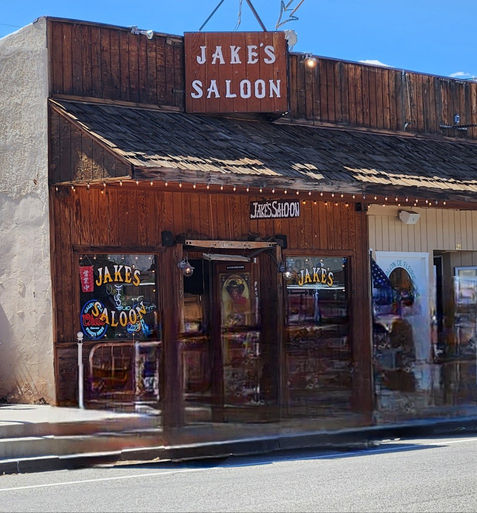
Time for a drink in a local saloon.


We got there just in time for a shoot out. Buddy wasn’t happy so he left until it was over. Bodies everywhere, I didn’t think I should show it.
A saloon employee or customer realized that Buddy left because of the gunfire and was waiting outside until it was over, so they brought a bowl of water out to him.
Good People!!
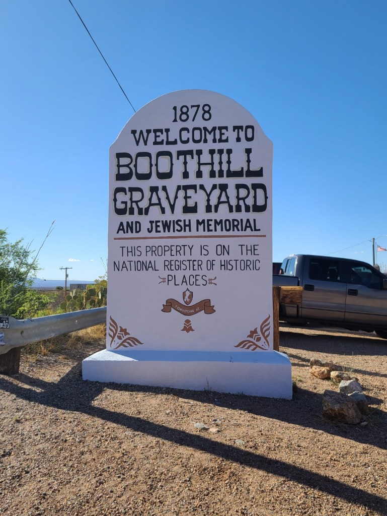
FYI: Neither the Earps or Doc Holliday are buried in Boothill Graveyard.

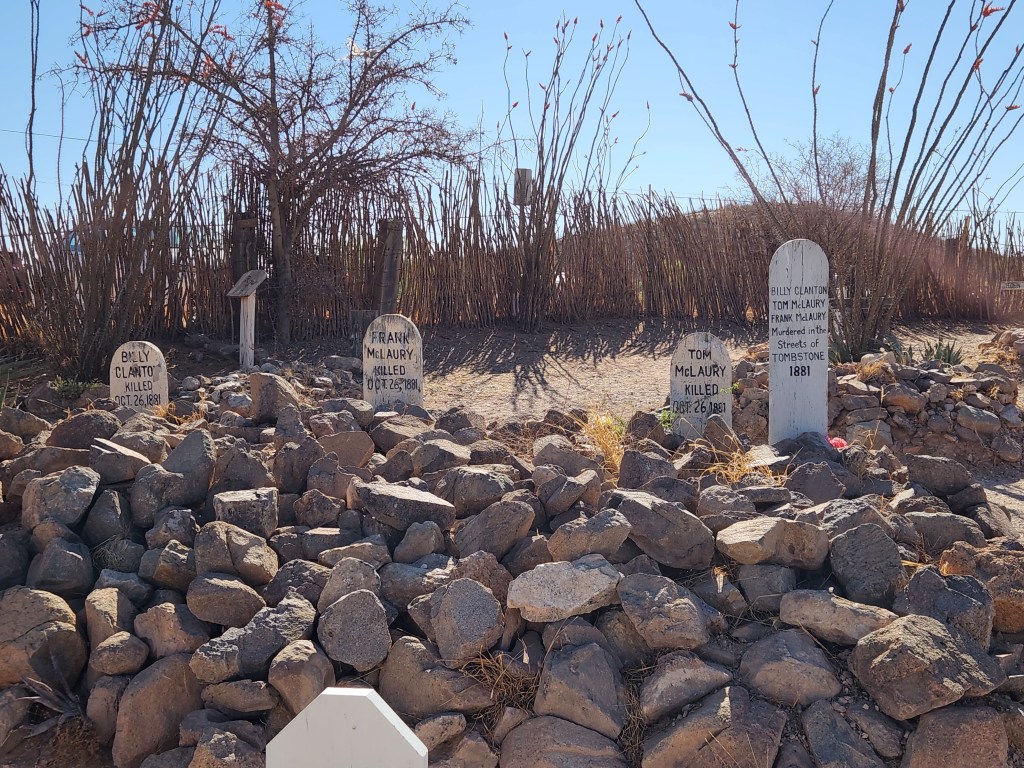
People do agree that the gunfight at the OK corral took place on October 26, 1881 and lasted for about thirty seconds. It is believed to be the most infamous shootout in the American West at that time.
The stories change somewhat after that. The actual location, the people in the shootout. That’s what history is, variations on a theme.
The gang known as the cowboys were confronted by Wyatt Earp and his deputies over a gun ordinance law. Two deputies were wounded and three of the cowboys were killed. Two of the cowboys ran because they weren’t armed.
Imagine being there. Twenty to thirty feet away from your opponent who is trying to kill you before you kill him. In the blink of an eye, thirty rounds were fired, killing three and wounding two. With the anxiety and adrenaline running through your body, you wouldn’t know if you were shot until you hit the ground or saw the blood.

There are a number of stories. Take time and read them.
Tom and Frank McLaury are buried in Boothill Graveyard in Tombstone, Arizona
Billy Clanton is buried in Boothill Graveyard in Tombstone, Arizona

Ike Clanton was present at the OK Correl shoot out but was unarmed and ran from the gunfight that his brother was killed.
Ike Clanton is believed to be buried in a shallow grave located near Eagle Creek in what is now Greenlee County, Arizona.
Billy Claiborne was present at the OK Correl shoot out but was unarmed and ran from the gunfight. A year later he was dunk at the Oriental saloon in Tumbstone and confronted Buckskin Frank Leslie and was killed. He is buried in Boothill Graveyard.


April 21st, 2025
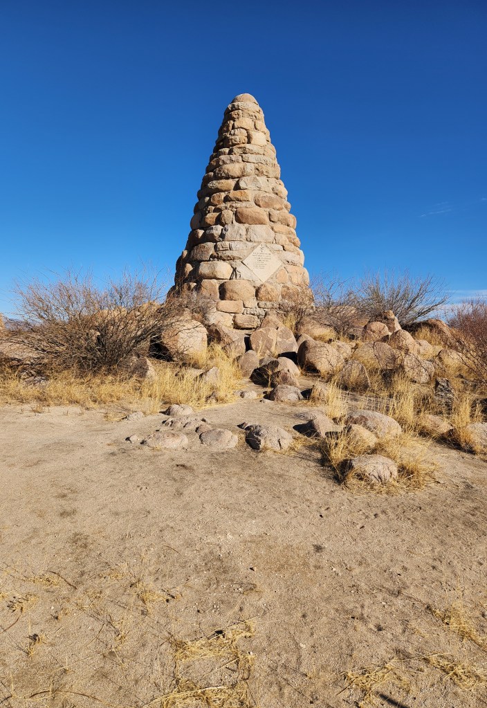
Silver City NM (172m), Another easy day. We started out by going to Ed Schieffelin monument. The monument is also his final resting place and is located about 3 miles northwest of Tombstone.
On the road again but we have to stop and see the “Thing”.
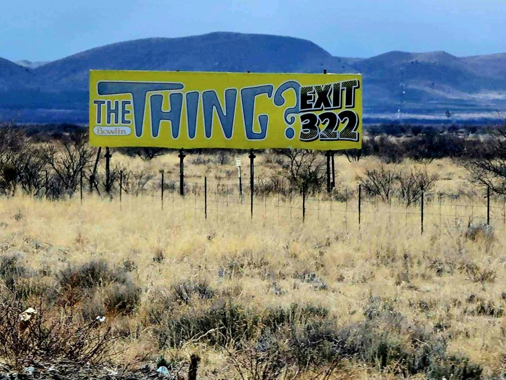
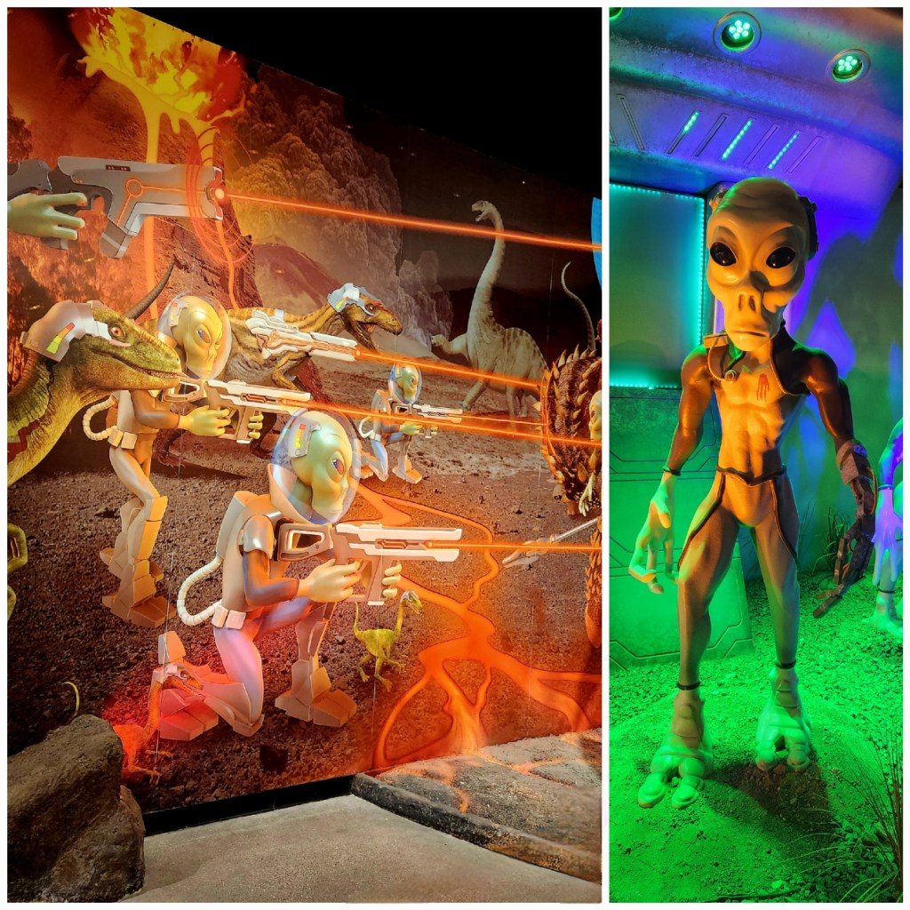
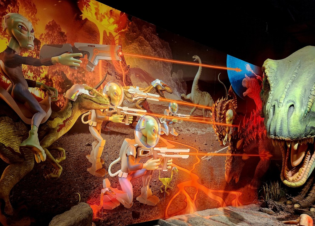

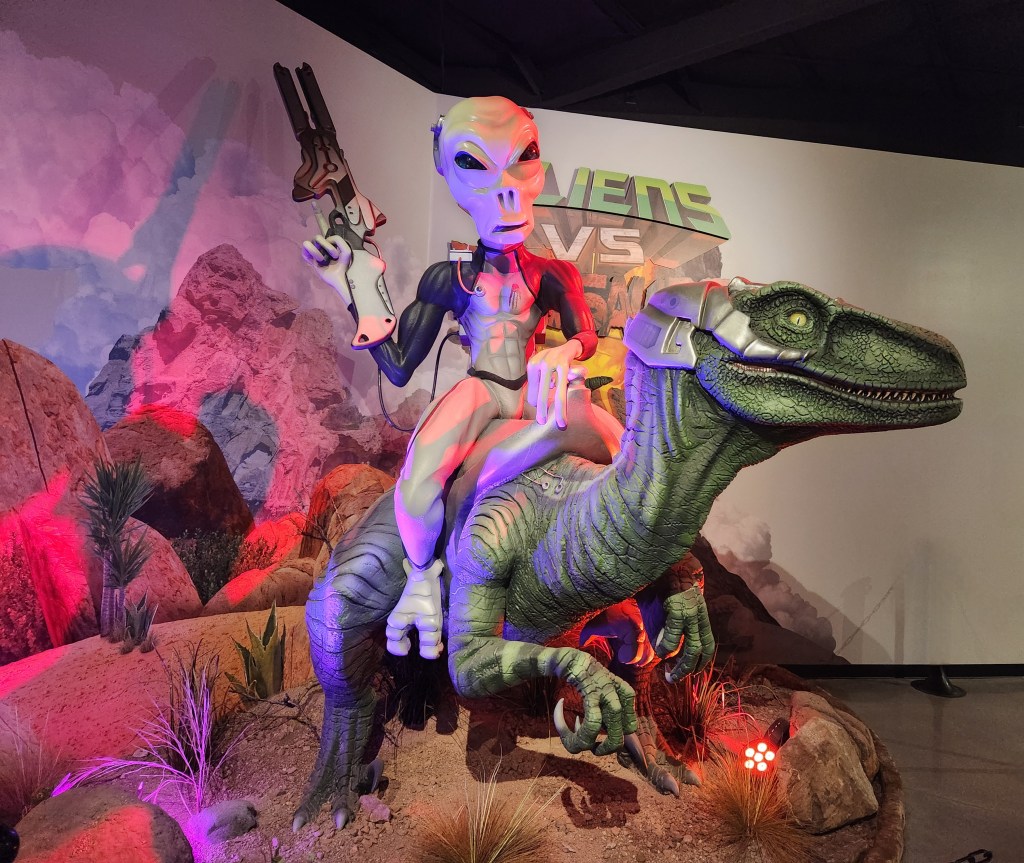
What influence have they had on us, are they watching, what are they waiting for.
We met some people while we’re there and the one man thought he had been to area 51 but he wasn’t sure. His confusion, what happened to him? delusional or not? Will he ever know?
April 22, 2025
Today we went to Our Lady of Guadalupe Benedictine Monastery. Located in the Southern Rocky Mountains near the Gila National Forest. We arrived in time to attend their noon vespers and see the chapel. After that we spent around an hour talking to one of the brothers. They live a very quiet and private life, are hard working and very willing to share the lords word with you.
The monastery operates a farm and a number of workshops where various arts and crafts of manual labor are exercised daily. Outside is where the animal husbandry and agriculture are performed within the fields and greenhouses to produce the products that support their vegetarian diet. The best way to see what they make in their shops is to visit the gift shop.


April 24th, 2025
We headed north on a day of exploration and found ourselves high in the mountains on a narrow road.
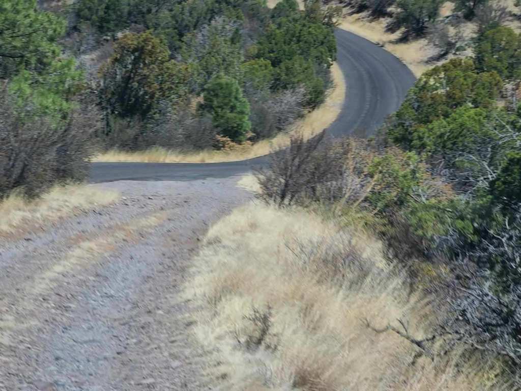

We couldn’t have asked for a more magnificent area to travel.


We came upon a rest area on top of a mountain that had more than magnificent views.
Several U.S. presidents played key roles in establishing our wilderness and expanding the national park system.
Theodore Roosevelt, Ulysses S. Grant, Woodrow Wilson, Jimmy Carter Lyndon B. Johnson.
All wanted to preserve our country.
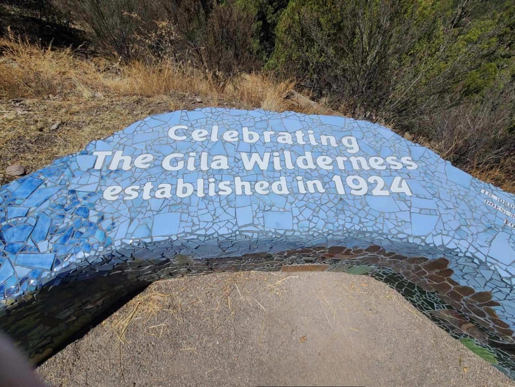
Don’t destroy their work now
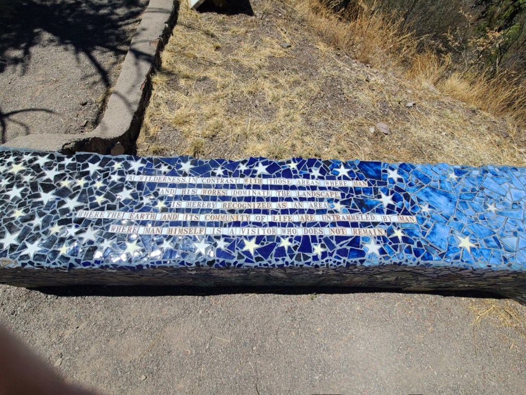
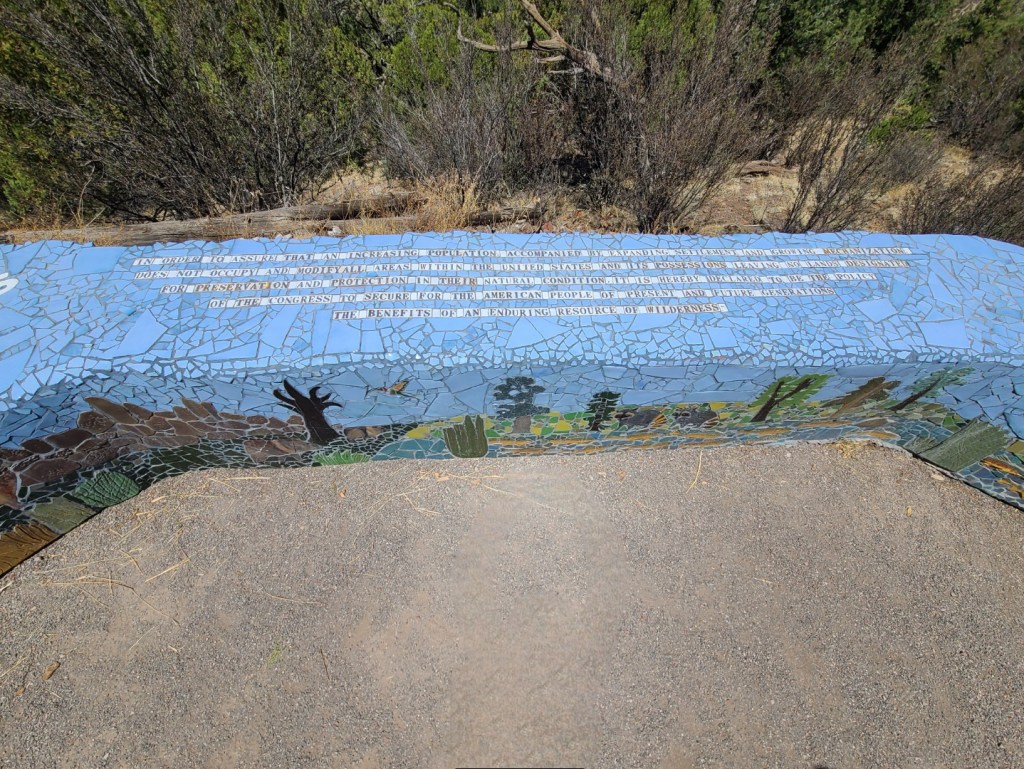
The Wilderness Act of 1964, signed by President Lyndon B. Johnson, was a landmark environmental law that established the National Wilderness Preservation System (NWPS). The act protected over 9 million acres of undeveloped federal land, and set criteria for future wilderness designations.
You may think the title is the“Wilderness Act.” In fact that is the short title (Section 1.). The complete title is, “An Act to establish a National Wilderness Preservation System for the permanent good of the whole people, and for other purposes.
Our government needs to read this before they destroy our country.
We ended up at Doc Campbell’s Post on the Gila river. This is a resupply point for people trekking the CDT. After we left there we came back through Lake Roberts.

Camping, fishing and hiking. If you run short on anything you can always go by the general store.
April 25th, 2025
I’ll try to let you know if Albert Hammond is right.
Lake Morena CA (567m)
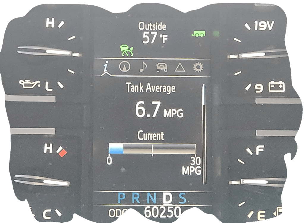
The wind out of the southwest isn’t helping our mileage and after we went through Tucson it got worse. We could see the dirt blowing through the fields. If we saw one dust devil today we saw thirty. There was a haze over the mountains all morning which is normally a combination of pollution, dust or dirt in the air and possibly smoke from fires. Years ago they said “if you have sinus problems move to Arizona”. Whoever said that had never been to Arizona. Dry air, dust, pollen. I think it will take a month to get all the dirt out of my eyes and my allergies have been really bad. Whoever said that must have hated the person they said that to.
April 26th, 2025
We had a slight detour this morning.


On the road again.
We had a twenty-one mph head wind that really effected our mileage.
Yes, it does rain in Southern California

Setup in the rain. Again!
April 27th, 2025
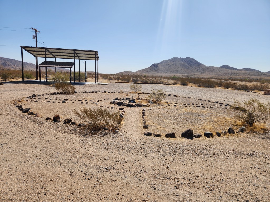
After morning coffee and a stop for gas we headed for the Southern Terminus of the PCT.
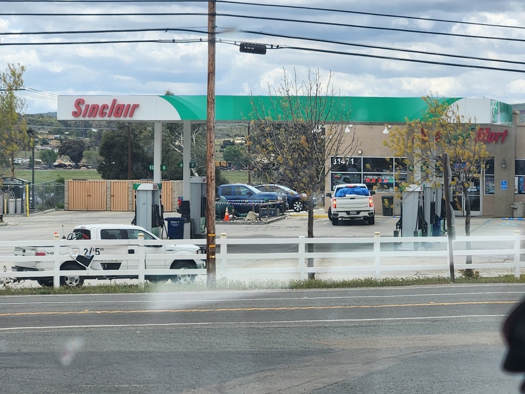
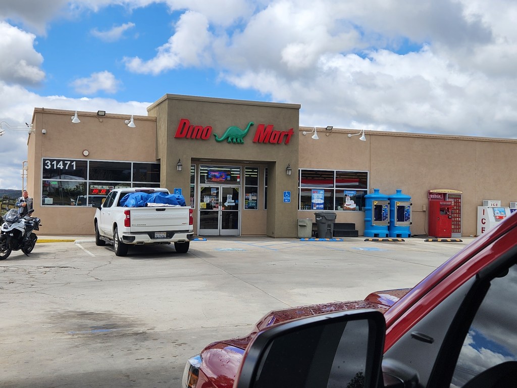
Wow, a Sinclair gas station, haven’t seen one in over fifty years.
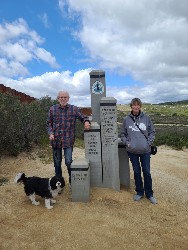
I know the new wall is for security but I don’t care for it.

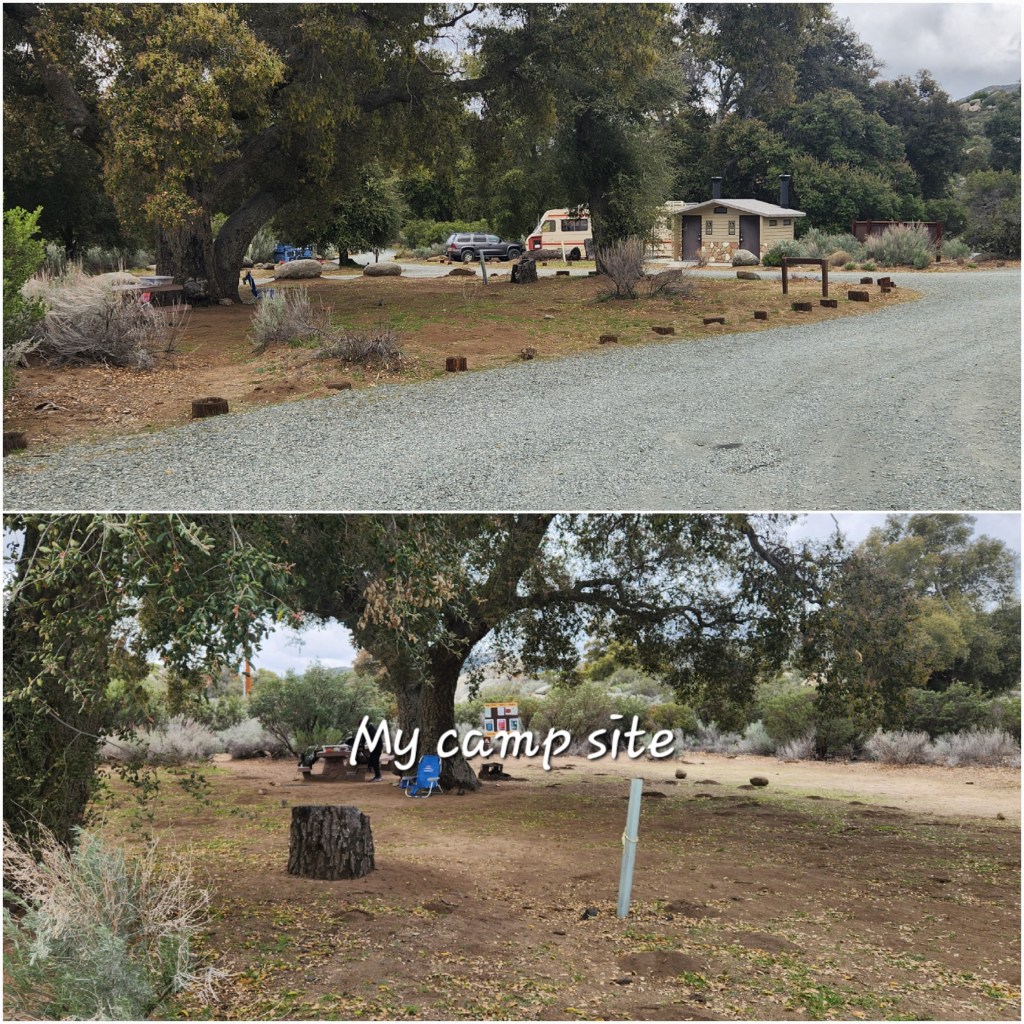
Boulder Oaks Equestrian Campground is about six miles north of Lake Morena butI have camped there just because it is such a nice campground. Since it is preseason, they don’t charge us.

Water
This is the first thing I remember seeing when I entered the campground.
We took a short walk down the trail to a creek just south of the campground.

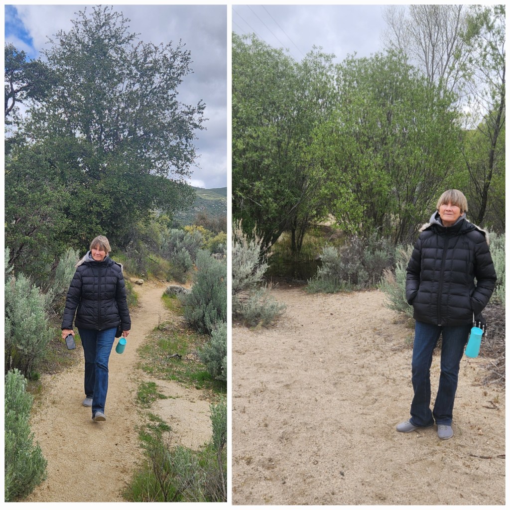

I remember crossing that creek in my bare feet and sitting on that tire to dry my feet and put my socks and shoes back on.
A lot of old memories!
So far we have been to the East Coast and the Southern Boarder of our country. Next will be the West Coast and then the Northern Boarder.
April 29th, 2025
Yesterday I had another tough day. I did a few jobs around the trailer, talked to some through hikers and Carol and I walked Buddy around the park and down to the lake.

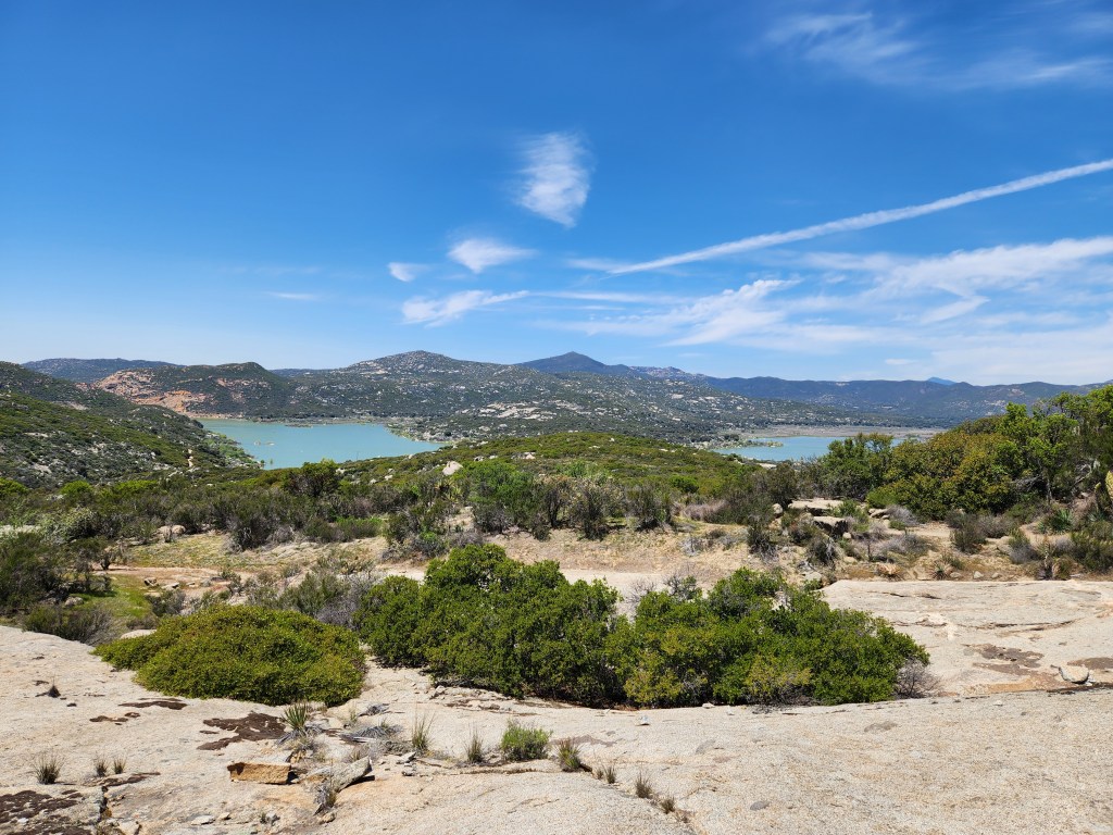
Lake Morena, situated in Morena Valley and serving as a water storage for San Diego.
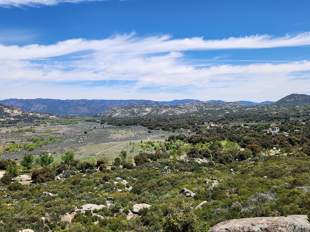
Today we went to Mount Laguna. Old stomping grounds. I wanted to show Carol the restaurant I spent the night at sleeping on the floor because it was twenty eight degrees outside and I had fourty degree equipment. There was about twenty of us that spent the night there. The owner was good enough to allow us to make coffee in the morning.


I spent the night on the floor in the corner where that little table is now.
Next we ended up at Storm Canyon Vista Trailhead.

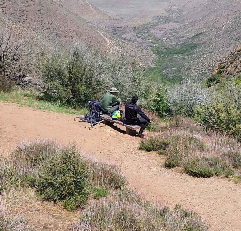
I spent time on that bench talking to a man from Colorado.
April 30th, 2025
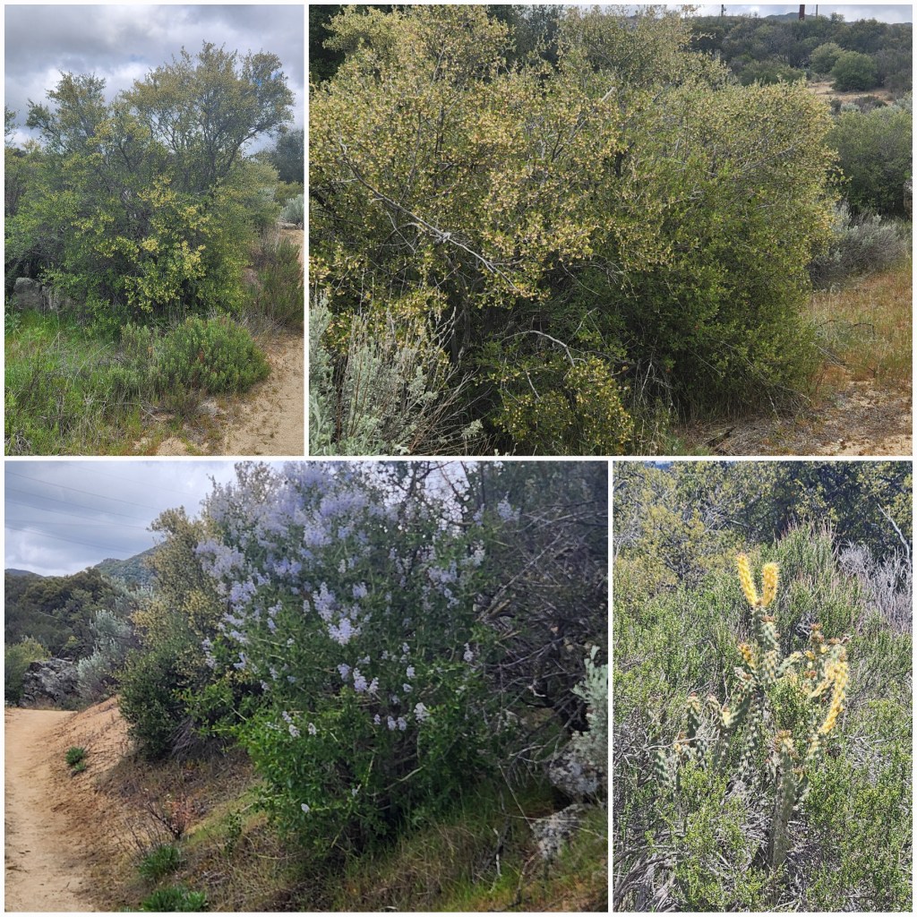
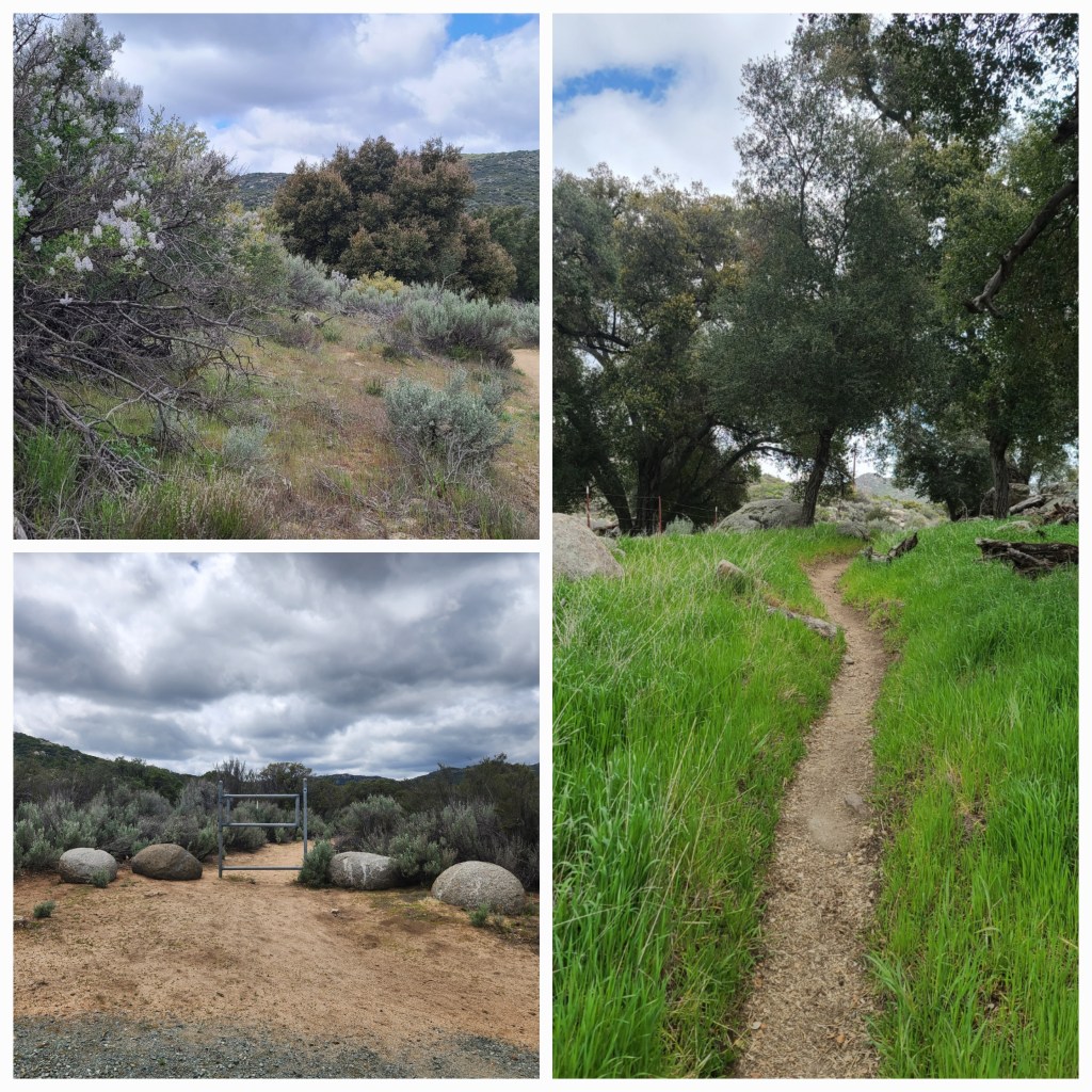
We headed south on the PCT towards Hauser Creek. I was only planning on going a couple miles instead of the five miles that it is and it was really nice hiking in the mountains again.

We had great weather for hiking. The weather is changing, I remember hiking this area at this time of year in the low eighties not the low seventies.
May 1st, 2025
There was a light fog over the mountains this morning.

No, those lights aren’t UFOs, they are reflections of the ceiling lights in the trailer on the back window. Or are they?
Headed north to Julian for the day. We did some shopping, stopped off to see a friend and went down to Scissors Crossing where we saw a mountain fire in progress and firefighters working hard to put it out.


After we got back to the trailer we headed north on the trail for a short hike.
May 2nd, 2025
A day of preparation. We walked the park to get some exercise, talked to some hikers and went down to the Malt shop, that has a little bit of everything.
May 4th, 2025
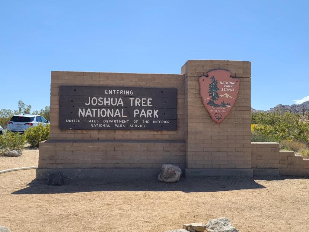
We had a short ride yesterday but nowhere to stay. Our reservations were for May fourth so we stopped by the park to see if we could get in early but the fourth wasn’t with us. We looked at BLM land and ended up at Joshua Tree Lake RV and Campground for the night, moving to our site at Joshua Tree NP this morning (160m). Yes it was raining and cold.
It does rain in Southern California.

The park we stayed in last night is a nice park and the pricing wasn’t bad but the NP is less expensive and it’s nice to do something different now and than. We are boondocking at a national park. Can’t get much more different. I ran the generator (inverter) this morning to charge the battery and make coffee. Here, we can only run it at certain times of the day for a short period.
When we stopped here Saturday to see if we could get in early, the campground was full but everyone is gone today.
Side note: With a tailwind and going down hill, our mileage improved.

The park roads were narrow, tight and virtually non-existent.
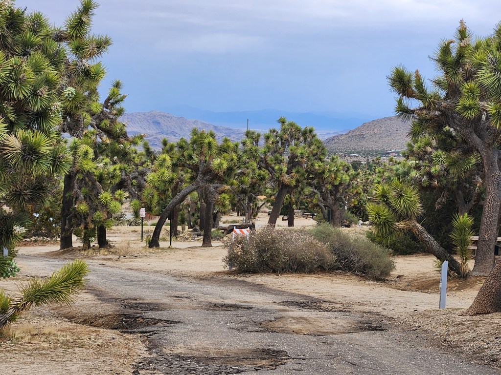
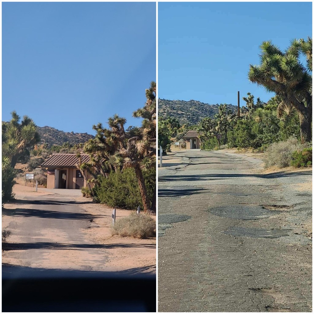
Very old pavement laid on sand.
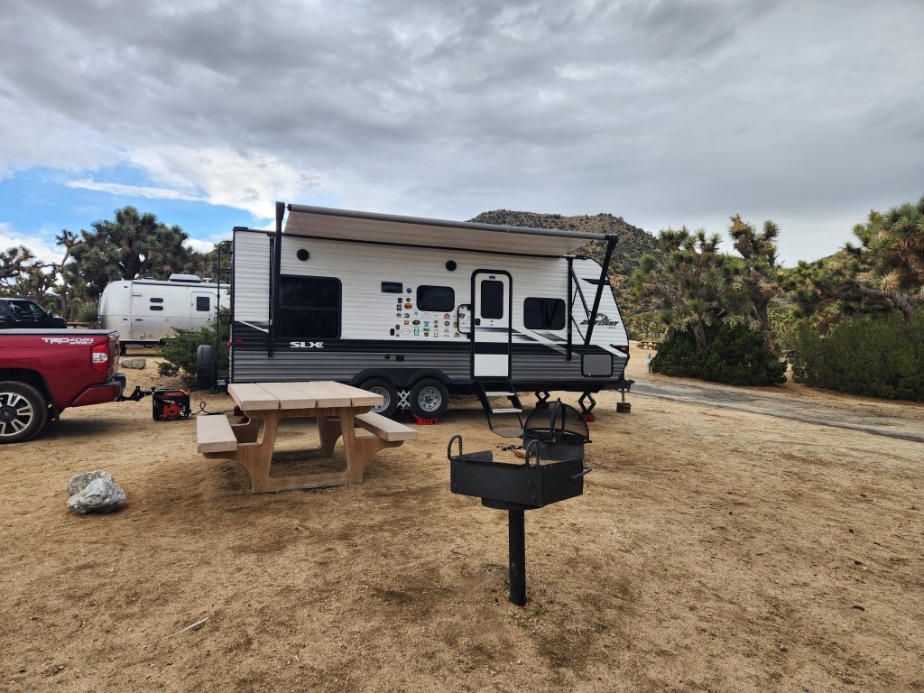
The fire rings have screen covers. I’ve never seen that before.

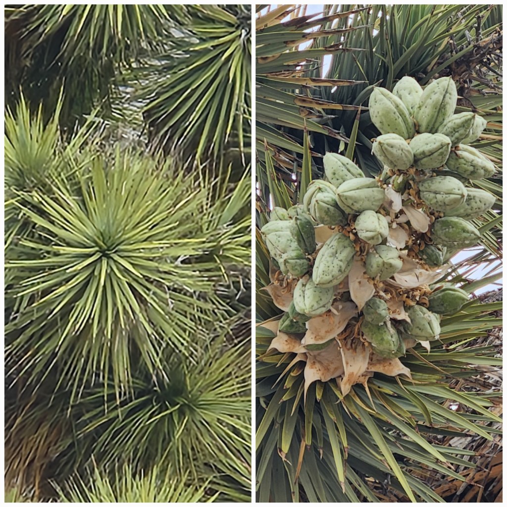
How did it become the Joshua tree?

Early Mormon settlers, who crossed the Mojave Desert saw the trees distinctive shape as resembling the biblical figure Joshua, who was depicted with his hands raised in prayer. They saw the tree’s outstretched branches as resembling Joshua’s posture.
May 5th, 2025
Today was a good day to visit the park office/gift shop and nature center before walking the oasis of Mara trail. With the rain we had, we found time to relax and enjoy our surroundings.
May 6th, 2025
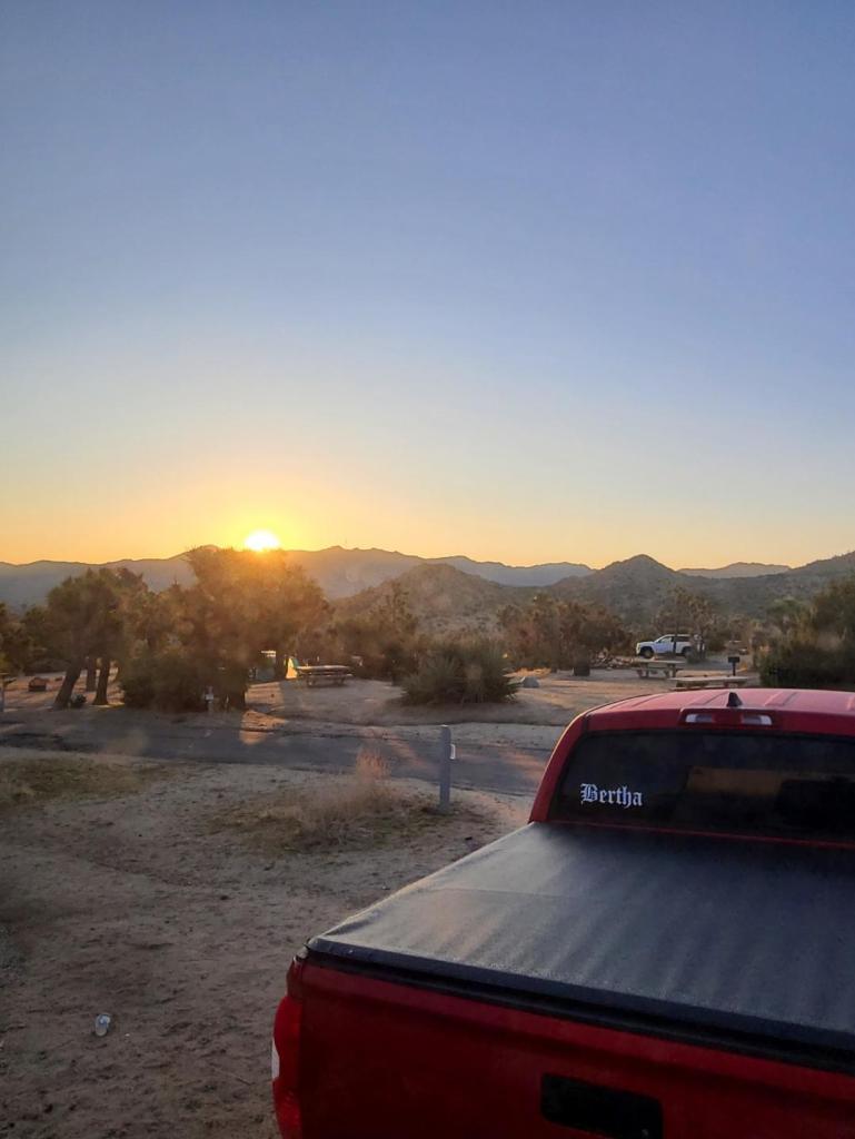
Our camp site at Joshua Tree is actually on the edge of the park. We spent a few hours on the interior roads and trails today.
The park has plenty to do. Historical sites, picnic grounds, campgrounds, hiking, back-country camping, dirt roads to explore or just a nice ride through a park.
We had a great time driving down a dirt road

when we had to decide what to do at an intersection. The map indicated that we should turn left, I wanted to turn right but it was marked one way, do not enter and Carol would have freaked. Straight was going to be a dead end. We went left and eventually got back to paved roads but we found out that turning right would have worked.

I would come back.
Time to start packing up so we can leave in the morning.
Our next stop is
Death Valley National Park
Once we are in Badwater Basin, you can say that you know people in low places.
May 7th, 2025
Time to say goodby.
Boondocking isn’t easy. It was in the mid forties last night when the battery died and we had no heat. Buddy got cold and got in bed with us, stretched out claiming his territory and most of the blankets.
He was warm.
It seems that people try to escape their daily lives by going to parks with the idea of being alone amongst a hundred other campers. They achieve this by failing to acknowledge the presence of others who they’re close enough to share a meal with or applying the common courtesies that I was raised with. Is it the misery of their daily lives they’re trying to escape or do they believe in their own self-importance.
More than likely, they’re just rude.
Reminds me of a song,
The Sound of Silence
May 7th, 2025
GPS has really taken us to see some remote areas of our country. We spent most of the day on back roads, nothing out here to spoil the natural beauty of evolution. Few houses and a lot of government land (BLM). Thank God our previous Presidents had the for-thought to preserve it for all of us.


it’s never-ending.
Death Valley National Park
Furnace Creek Campground (265m)
Temperature, mid nineties
Full service sites all taken
Hours from a full service RV park
We parked in a site without any service and pulled out the generator. During the day everyone is out exploring the area so running a generator didn’t bother anyone. I turned it off when people started returning for the evening.
We decided to stay the night and see if we could get a site with electricity and water in the morning. After sunset the temperature started to drop to a low of 72°. With no lights in the campground and clear skies it turned out to be a great night for stargazing. We spent the night with all the windows open and slept well until around 2am when the battery lost power. The refrigerator started beeping and Carol woke me up. I turned it off and went back to bed.
May 8th, 2025
We were up early because of the loss of power and our desire to get a full hookup site. We were out walking Buddy when Buddy and I noticed a coyote checking him out. The coyote was only about a hundred feet away so we decided to go back to the trailer and the coyote followed until another camper came out to take a picture and the coyote was scared off.

Life is good, again. We got a full hookup site, the refrigerator is running and we don’t need heat at night. Time for a shower, its been a few days.
I understand why they call this death valley.
Today 104° and going up the next few days.
Some of the places we’re going are on old dirt roads and the temperature is going up so I am looking up emergence numbers and we’ll take extra water and snacks with us. We plan on leaving early but it gets hot early here. We have the air-conditioner on and it is around 79° in the trailer but Buddy is having a problem with the heat. He is panting constantly and acting peculiar. We took him for a truck ride until he cooled off and the trailer cooled down more.
May 9th, 2025
Our seventh month on the road and we are still talking to each other.
If you ever go to Death Valley pack everything you need. The cost of gas is outrageous
and the cost of beer is seventeen dollars up. I talked to a woman at the gas station that went to buy a gallon of water at the gas station and they wanted five dollars. I am sure glad our government protects us from price gouging.
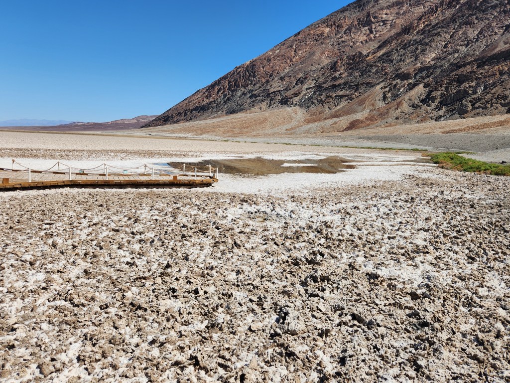
We headed to Badwater Basin which is two hundred and eighty-two feet below sea level. This is the eighth lowest and hottest place in the world.
Next on our list is Pahrump NV for groceries at a reasonable price.
It was 94° in Pahrump and 105° at Furnace Creek one hour later.
When we got here Wednesday the campground was over half full with all the electric sites occupied. Thursday almost everyone left and we ended up with our choice of electric sites. The next few days were going to be over 100°, I understand why they left.
The water at furnace creek is so warm that we turned off our water heater.
Forgetting the above, Death Valley is a magnificent area that seems to go on forever. From the basin to the mountain tops the color and terrain is forever changing leaving me amazed at every view. We are going to stay for a week probably and the temperature is expected to drop below 100° in a few days. I am sure that we will enjoy our stay but there will be much more to see in the future.

Sodium Chloride—better known as table salt—makes up the majority of salts on Badwater Basin. Other evaporative minerals found here include calcite, gypsum, and borax.
The salt flats in Badwater Basin cover nearly two hundred square miles, among the largest protected salt flats in the world.
The source of Badwater’s salts is Death Valley’s drainage system of nine thousand square miles—an area larger than New Hampshire. Rain falling on distant peaks creates floods that rush ever lower. Along the way, minerals dissolve from rocks and join the flood. Here, at the lowest elevation, floods come to rest, forming temporary lakes. As the water evaporates, minerals concentrate until only the salts remain. After thousands of years, enough salts have washed in to produce layer upon layer of salt crust.

We also stopped at The Devils Golf Course to see some very rough terrain and sodium crystals.
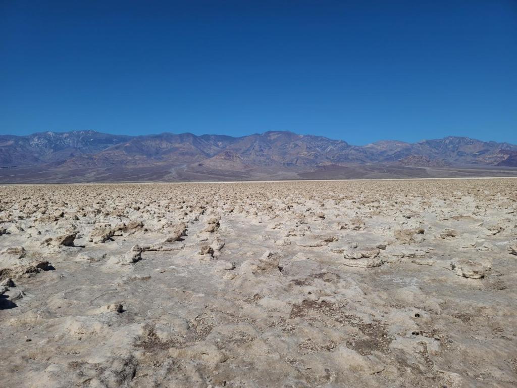
This is an immense area of rock salt, eroded by wind, rain and time into jagged spires. So incredibly serrated that they say “only the devil could play golf on such rough links”.
May 10th, 2025
We were going to ghost towns this morning and ended up at the Keane Wonder Mine. The goldmine was active from nineteen hundred and seven to nineteen hundred and twelve.
From what I understand, the mine was on top the mountain and the ore was brought down to the mill by a tramway for processing.
With the temperatures we were experiencing in the area and the affect it was having on Buddy, we decided to head for the mountains.
May 11th 2025
I was headed for Kennedy Meadows CA and ended up in Lone Pine CA (105m)
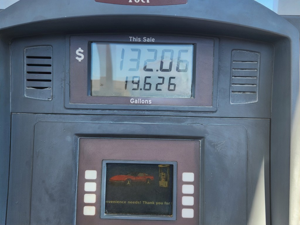
On the way we stopped at Stovepipe Wells Village for gas where it was three dollars and eighty cents a gallon yesterday and today all four gas pumps were OUT OF ORDER. They were being worked on with no hopes of a quick fix. We had plunty of gas but I seem to have a lot of problems with gas pumps.

We had a very unexpected ride through the mountains. They road was very narrow with tight turns climbing up the side of the mountain before doing the reverse on the other side. Most of the road was without guard rails. Being on the outer lane left Carol a little on edge.

I wanted to show Carol a few places in Lone Pine before we went to Kennedy Meadow.
I showed Carol the old Dow Hotel built in nineteen hundred and twenty-three to house actors and movie industry personnel during filming on location.


Dow Hotel hosted, numerous Hollywood personalities over the years.
Richard Farnsworth, William Boyd, Stewart Granger, Errol Flynn, John Wayne and Robert Mitchum just to name a few along with actresses, directors and producers.
It’s like riding through history.
I thought I would take Carol to the Mt Whitney Portal not remembering the ride up. This road, thirteen miles, and a good part of it on the side of a mountain. Narrow winding switchbacks going to an elevation of eight thousand three hundred and seventy-four feet ASL from Lone Pine which is four thousand two hundred and three feet ASL.

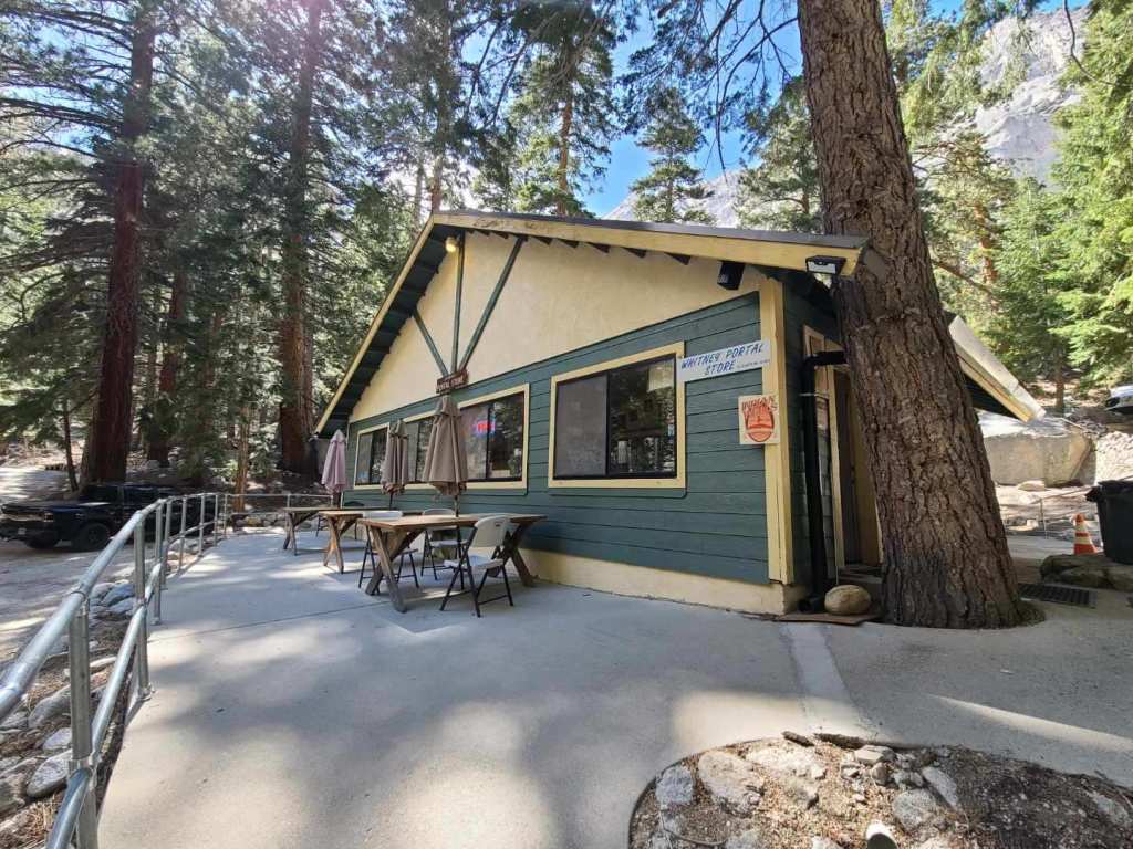


Once we were at a lower elevations Carol went shopping at Lone Pine while Buddy and I stopped off at a local watering hole for a drink.

When we were finished shopping we picked-up dinner at McDonald’s and headed home.
May 12th, 2025
After all Carol has gone through with mountain roads I wasn’t sure about taking her up another mountain road six thousand two hundred and fourteen feet ASL to Kennedy Meadows to see the old store, campgrounds and general area.
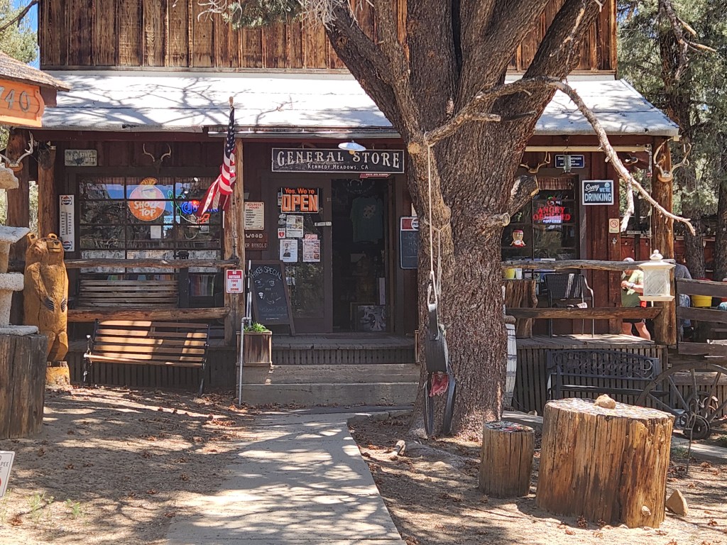

It was sweet&sour. The general store is for sale again and not doing well. A few years ago an outfitter “TCO” set up shop a couple miles down the road from Kennedy Meadow general store next to Grumpy Bear’s restaurant trying to take over and put the general store out of business. I don’t think TCO is doing well and I know the general store isn’t. Grumpy Bear’s is the only one that will benefit.
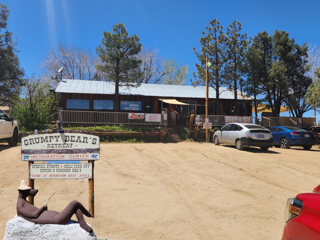
We had a nice day and Carol was fine with the road. It was nice to see the area again and I stopped and got a burger and fries at Grumpy Bear’s for us to share on the way down.
If you are interested they are asking around six hundred and fifty thousand for the general store.
May 13th, 2025
The wind last night was the strongest we have had. We had gusts around fourty mph broadsiding the trailer.
We were leaving Lone Pine this morning but weren’t sure where to go so we let the weather guide us again. We decided to go south to Lake Isabella. They were having good weather and it looked like a nice area to explore.
On our way there we went by Walker Pass. This is an area on the PCT South of Kennedy Meadow that I have hiked through.
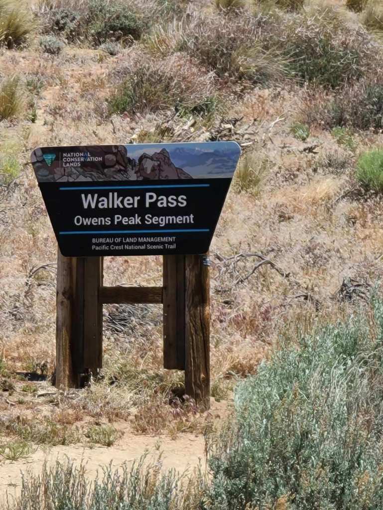
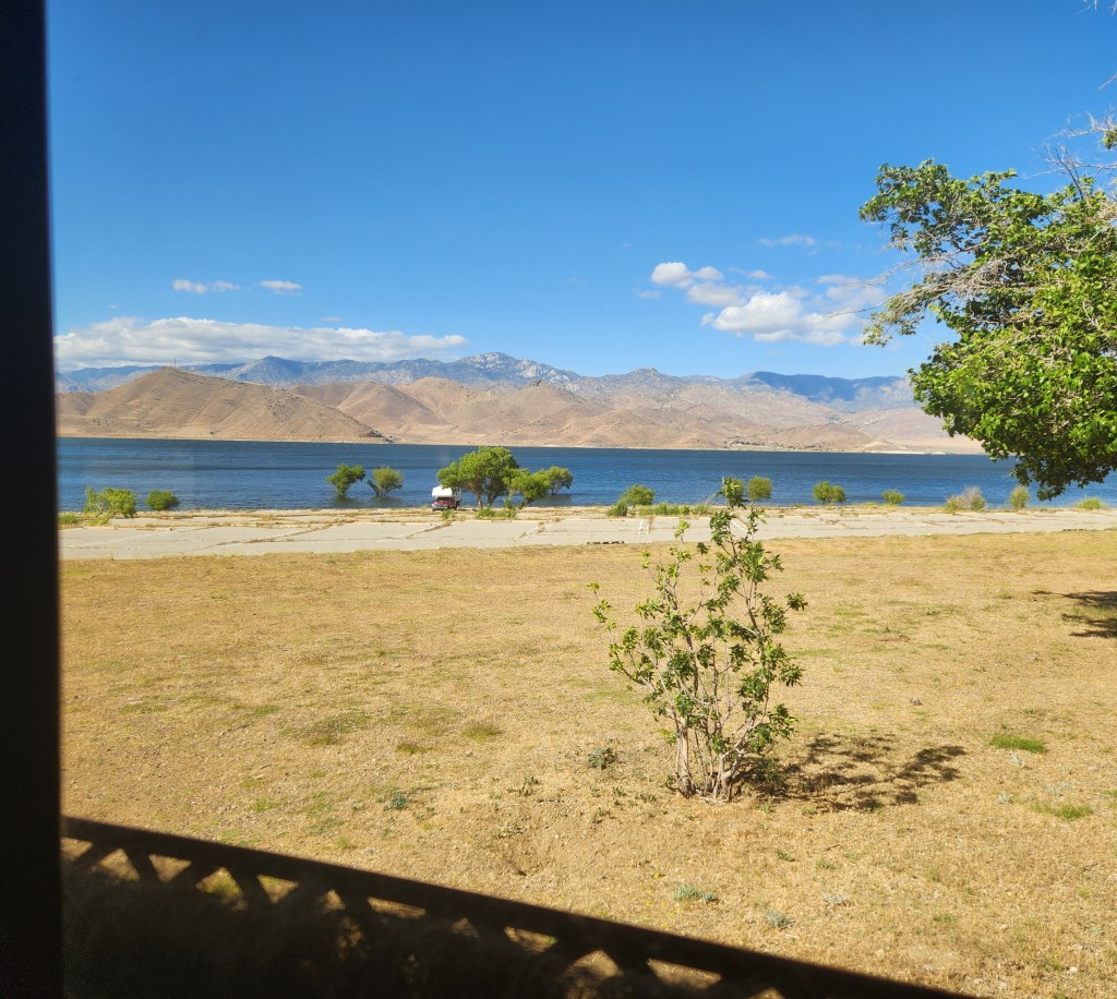
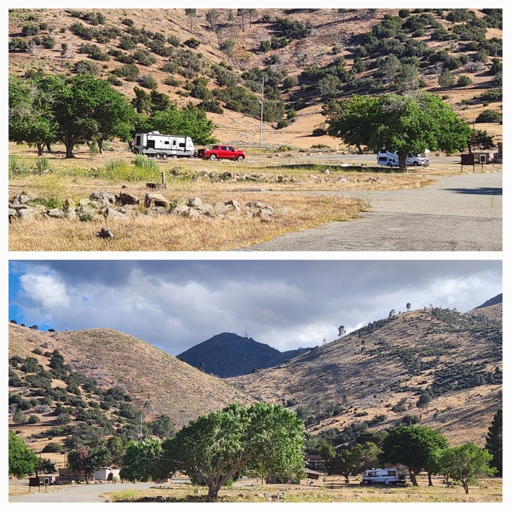
The trail goes by Chimney Creek campground where I have stopped before to spend the night. Mohawk, a trail angel normally spends memorial weekend there feeding hikers. The wind picked up as we approached lake Isabella and the weather report wasn’t in our favor. We ended up making reservations at Sun Outdoors San Diego Bay for a week. We are spending the night at Paradise Cove campground lake Isabella (111m) which is part of Sequoia National Forest.
May14th, 2025
One more mountain road to Bakersfield than South to Sun Outdoors San Diego Bay.

You must be logged in to post a comment.